
PIM-SAT-M, AI enabled web-based platform for monitoring of the stability of structures and nearby areas, using satellite data.

Domain #2
Disaster resilience

Demonstrator
![]()
Open Call #1 laureate
Description of the project
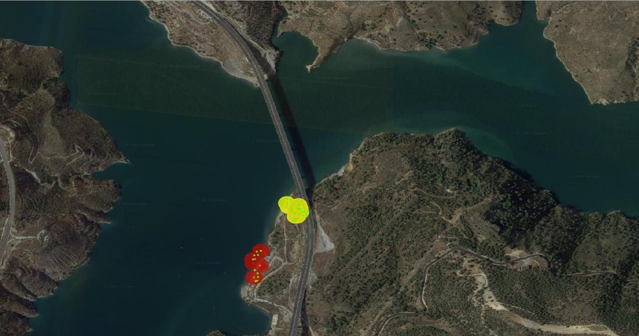
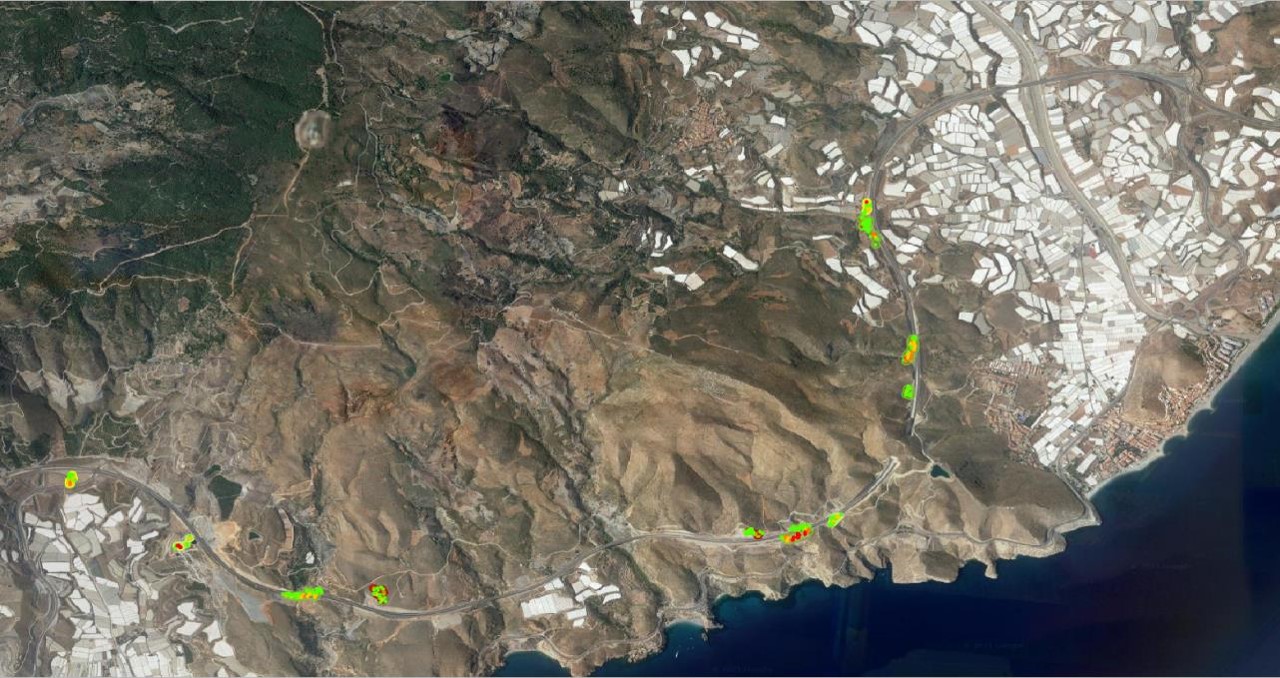
Land deformation is a serious problem for a number of industries, infrastructures and habitational areas. Aggravated by the climate change and increasing natural resources exploitation it grows bigger. Despite proliferation of sensors, responsible managers lack cost effective and reliable tools to analyse risks, and visual observations remain widespread, needless to say, inefficient. The project aims to pilot an AI enabled, web-based platform, which would serve as an efficient tool to monitor stability of structures and nearby areas.

Mid-term project update
The progress of the PIM SAT M project in the first 6 months has been exceptionally strong. All the planned milestones have been reached, completing visualisation components development, starting the data integration, receiving stakeholders’ feedback on analysis results and visualisation tools, identifying pilot sites and starting data collection. Data analysis over the pilot areas were completed ahead of the schedule. Data collection and analysis is currently carried on, and data integration and visualisation has started. The project continues in accordance with the plan in close and effective collaboration of the consortium partners and with sturdy support of the SecurIT consortium.
Final project update
Project consortium

Spain

Italy